
2 Groups Available
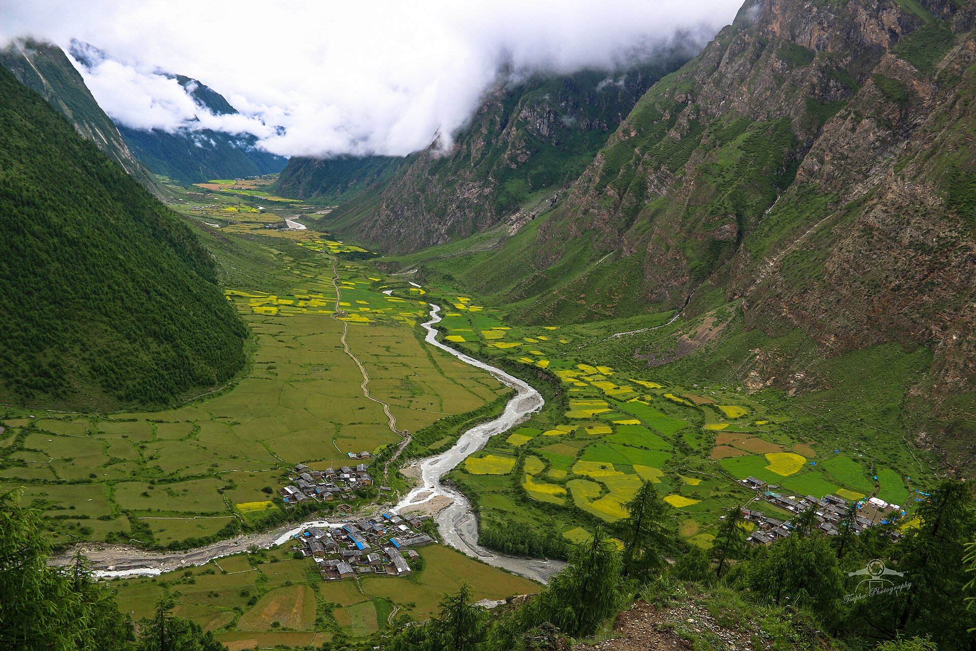
The Tsum Valley Trek is a fascinating journey through the remote Manaslu Conservation Area in northern Nepal, leading into the sacred Himalayan valley blessed by the meditation and teachings of the Buddhist saint Milarepa. Covering approximately 140–170 kilometers round trip, the trek rises from the lower Budhi Gandaki Valley to Mu Gompa (about 3,700 m) and other high-altitude settlements beneath the dramatic peaks of Ganesh Himal, Sringi Himal, Boudha Himal, and Himalchuli. Major attractions include Chhokang Paro, Rachen Gompa, Mu Gompa, Milarepa’s Cave (Piren Phu), and ancient monasteries that preserve centuries-old Tibetan Buddhist traditions.
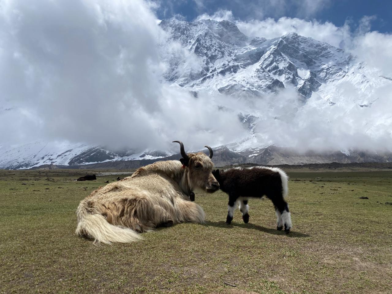
The valley is inhabited mainly by people of Tibetan origin, whose culture, language, and daily life are deeply influenced by Tibetan Buddhism. Prayer flags, mani walls, chortens, and monasteries highlight the region’s strong religious identity. The landscape features forests of pine, juniper, and rhododendron at lower elevations, gradually changing into alpine meadows and rugged mountain terrain. Local livelihoods depend on farming and livestock, including yaks, cattle, sheep, and goats, while the conservation area supports wildlife such as the snow leopard, Himalayan tahr, blue sheep, musk deer, and Himalayan monal. With its sacred heritage, pristine environment, and rich culture, the Tsum Valley Trek offers one of Nepal’s most unique and spiritually rewarding trekking experiences.
Tap a day to expand the details.
The journey starts early with a long drive west and then north out of the Kathmandu valley, following the Prithvi Highway along the Trishuli River before turning off at Dhading Besi towards Gorkha. The road deteriorates steadily into a rough track that climbs and drops along the hillsides, passing terraced farmland, roadside bazaars and villages where the Budhi Gandaki comes into view far below. Arughat is a busy trading town on both banks of the river, the traditional starting point for both the Manaslu and Tsum Valley treks, where your crew will finish the last preparations for the trail.
Walking begins on the west bank of the Budhi Gandaki, following a wide trail through rice terraces and millet fields with the river running below. The valley here is subtropical and warm, with banana palms, bamboo and mango trees, and villages of Gurung and Hindu hill castes spread across the slopes. The path crosses side streams on small bridges and passes the village of Arkhet before reaching Soti Khola, set among sal trees just after a suspension bridge over the tributary that gives the village its name.
A shorter day, but a more rugged one, as the valley narrows into a gorge. The trail climbs onto a ridge above rapids, winds through sal forest and crosses several landslide sections on stone paths cut into the cliff. You pass through Khursane and the Gurung village of Labubesi, with the river below turning wide and braided over pale sand. After crossing the Budhi Gandaki on a long suspension bridge, a final stretch of riverbed walking brings you to Machha Khola, a string of teahouses beside the ‘fish stream’ it is named after.
A long day upstream through the narrowing gorge. The trail crosses the Tharo Khola and reaches Khorlabesi, then passes the small hot spring at Tatopani, where a soak is popular on the way out rather than in. Beyond it the path climbs over a ridge on a staircase carved into the rock, crosses the river twice and passes through Doban and Yaruphant, where the valley opens briefly into terraces. Jagat is a neat village of stone-flagged streets and the site of the Manaslu Conservation Area checkpost, where your restricted-area permits are registered.
Today the trail leaves the main Manaslu route at the Tsum turning and begins to climb in earnest. From Jagat the path ascends through Salleri, with views opening towards Sringi Himal, then drops to Sirdibas and crosses the river on a long suspension bridge to Philim, a large Gurung village surrounded by maize fields. Beyond Philim the route turns north into the Tsum valley proper, climbing through a narrow gorge of pine and rhododendron to Chisopani, where the pilgrim trail to the sacred valley begins.
A demanding day on an exposed trail high above the Siyar Khola, with several sections cut into the cliff face and short ladders and bridges along the way. The gorge is spectacular, dropping hundreds of metres to the river, and waterfalls come down the far wall. As the valley opens out, the first mani walls and chortens of Tsum appear, painted in white and red, and the architecture changes to flat-roofed Tibetan stone houses. Chumling, the lower Tsum settlement, has an old gompa and views north to Ganesh Himal, which closes the head of the valley.
A gentler climb into the heart of the valley. The trail crosses the Siyar Khola on a suspension bridge and contours through fields of barley and buckwheat, past long mani walls carved with prayers and lines of chortens. Rebuilt villages and stone-walled paddocks show the traditional agriculture that has continued here for centuries, and the Tsumba people you pass speak their own dialect and follow a strict local custom of non-violence towards animals. Chhokang Paro is the largest settlement in upper Tsum, sitting on a wide shelf with Ganesh Himal and Himalchuli in view.
Continuing north towards the Tibetan border, the valley grows drier and more open, and the peaks close in. The trail passes Lamagaon and crosses to Rachen Gompa, one of the oldest nunneries in the valley, whose main hall is covered with murals and houses more than a hundred nuns. Nearby is Piren Phu, the cave where the saint Milarepa is said to have meditated, decorated with prayer flags and rock carvings. From there the path climbs steadily through Lar and Phurbe to Nile, the last village on the west bank before Mu Gompa.
A short morning’s walk brings you to the end of the valley. The trail climbs gradually through high, treeless country where only juniper and scrub survive, with yak pastures and stone shelters scattered across the slopes and the Tibetan border ridge visible ahead. Mu Gompa, at 3,700m, is the highest and oldest monastery in the Tsum valley, a walled complex of monks’ quarters around a prayer hall holding old thankas, statues and religious texts. The afternoon is free to rest, adjust to the altitude and look around.
A day at the top of the valley, both for acclimatisation and because there is a lot to see. You can walk up to Dhephyudonma Gompa, one of the oldest monasteries in the region, set on a hillside with wide views back down the valley, or continue towards the Ngula Dhojhyang pass on the Tibetan frontier, once used by salt-trading caravans. Blue sheep and Himalayan tahr are often visible on the slopes, and the monks at Mu Gompa are used to visitors sitting in on the morning prayers. The thin air and silence here are what most people remember of Tsum.
Turning south, you retrace the valley towards Chhokang Paro and then take the eastern trail to Burgi village, a small settlement below the Milarepa cave complex. The walking is mostly downhill and the perspective is completely different heading south, with Ganesh Himal ahead all day and the light on the valley walls changing hour by hour. Burgi is a quiet place of a few stone houses and barley terraces, and from above the village there are views across to Poshyop Gompa and the peaks along the Tibetan border.
The descent continues through the middle of the valley, back down through Chhokang Paro and the string of mani walls and chortens you passed on the way up. Losing height brings back trees, first juniper and pine, then rhododendron, and the temperature rises noticeably through the day. There is time to stop at Gonhgye Gompa or the small village shrines that are easy to miss when walking uphill. Chumling’s lodges feel comfortable after the high country, and the evening usually brings clear views of Ganesh Himal turning pink at sunset.
A long descent out of the sacred valley and back to the Budhi Gandaki. The trail follows the exposed cliff path above the Siyar Khola, crossing the ladders and rock-cut sections again, then drops steeply through pine forest to rejoin the main valley near Lokpa. From there it is a contouring walk south to Philim, with its terraced fields and the large school built by Japanese trekkers. The subtropical warmth returns quickly at this height, and Philim marks the end of the restricted Tsum permit area.
Retracing the lower gorge, the trail drops from Philim past Sirdibas and Jagat and follows the Budhi Gandaki downstream, crossing and recrossing on suspension bridges. It is easier walking than the climb in, though there are still short ascents over the landslide sections and rock staircases. You pass the hot spring at Tatopani, where most groups stop for a soak on the way out, before continuing to Khorlabesi, a small village of teahouses beside the river at under a thousand metres.
Another day along the river, through the narrow part of the gorge where the trail is cut into the cliffs above the rapids. The valley is green and humid at this altitude, with bamboo, banana and sal forest, and villagers working in the maize and millet terraces. You cross the long suspension bridge below Machha Khola and follow the wide riverbed through Khursane and Labubesi, arriving at Soti Khola in the afternoon. It is the last night on the trail, and the lodges here feel positively luxurious after two weeks in the mountains.
A short and easy final walk along the west bank of the Budhi Gandaki through rice terraces and farming villages brings you back to Arughat, where the road begins. From there the long drive back to Kathmandu retraces the rough hill road to Dhading Besi and then the Prithvi Highway along the Trishuli River, with stops for lunch and tea along the way. You reach Kathmandu in the evening and are transferred to your hotel, with time to shower, rest and celebrate the completion of the Tsum Valley trek with your crew.
No reviews of this trek yet — if you have trekked it, yours would be the first.
Log in to share your experience of this trek.